| Talon's Grasp | ||||
|---|---|---|---|---|
 | ||||
| Released | 5 January 2017 (Update) | |||
| Members | Yes | |||
| Location | Kebos Lowlands | |||
| Map | ||||
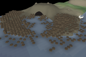
Talon's Grasp is a claw-shaped bay on the south-western edge of the Kebos Lowlands. It and the surrounding waterway separate Mount Quidamortem and the Stranglewood.
There is a rowboat at the far end which transports players between Mount Quidamortem and The Stranglewood, used in Desert Treasure II.
Changes
| Date | Changes |
|---|---|
| 5 November 2025 (Update) |
The area was given a name on the world map. |
Trivia
- The basalt columns forming the claw shape may be a reference to the Giant's Causeway in Northern Ireland. Similar basalt rocks can also be found near the Rogues' Castle, Daimon's Crater, and near the Lighthouse.